Mass loss of the Amundsen Sea Embayment of West Antarctica from four independent techniques
by T. C. Sutterley, I. Velicogna, E. Rignot,
J. Mouginot, T. Flament, M. R. van den Broeke,
J. M. van Wessem and C. H. Reijmer
Geophysical Research Letters (2014)
Abstract:
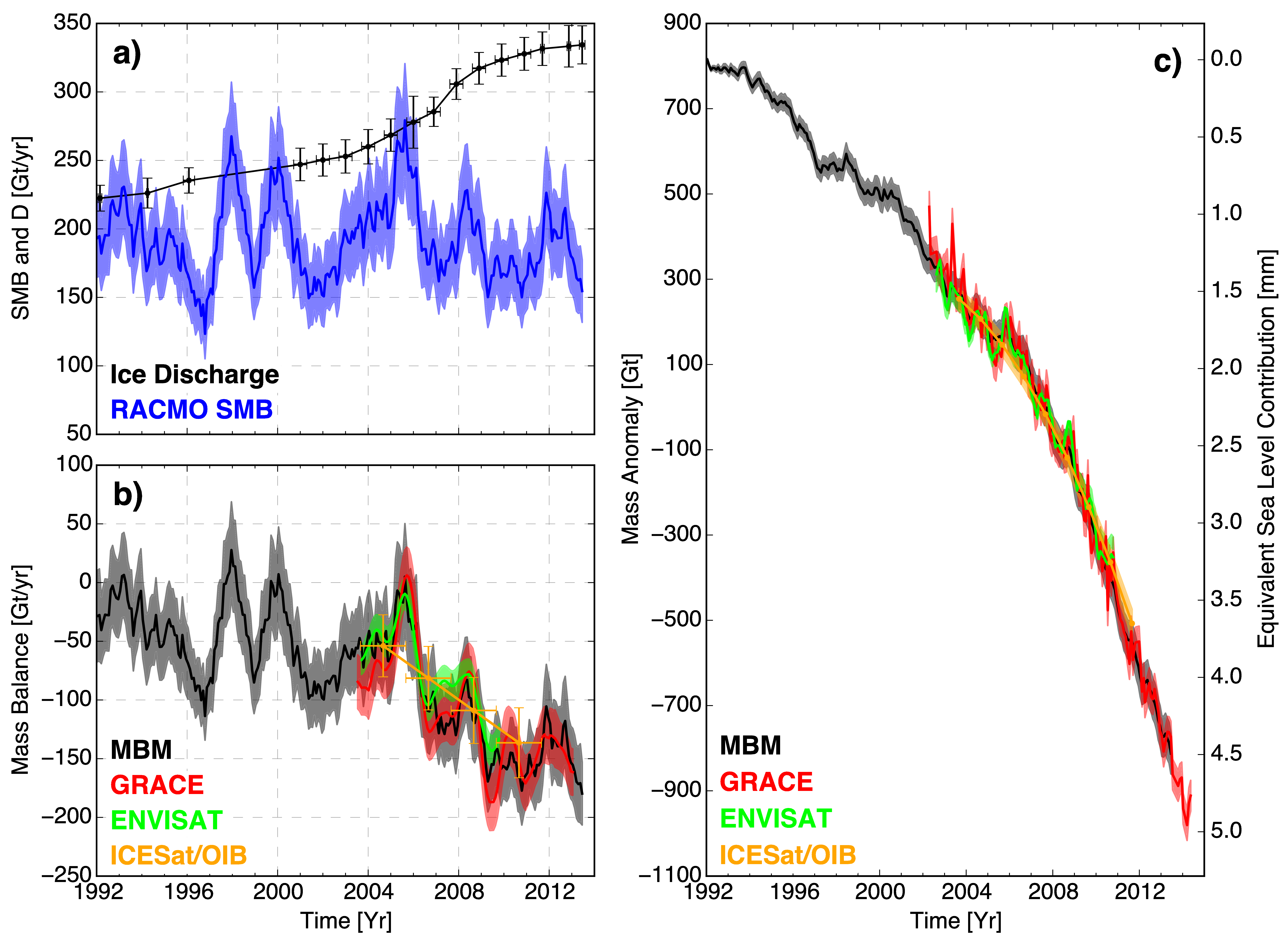
We compare four independent estimates of the mass balance of the Amundsen
Sea Embayment of West Antarctica, an area experiencing rapid retreat and
mass loss to the sea. We use ICESat and Operation IceBridge laser altimetry,
Envisat radar altimetry, GRACE time-variable gravity, RACMO2.3 surface mass
balance, ice velocity from imaging radars, and ice thickness from radar
sounders. The four methods agree in terms of mass loss and acceleration in
loss at the regional scale. Over 1992–2013, the mass loss is 83 ±
5 Gt/yr with an acceleration of 6.1 ± 0.7 Gt/yr2. During the
common period 2003–2009, the mass loss is 84 ± 10 Gt/yr with an
acceleration of 16.3 ± 5.6 Gt/yr2, nearly 3 times the
acceleration over 1992–2013. Over 2003–2011, the mass loss is
102 ± 10 Gt/yr with an acceleration of 15.7 ± 4.0
Gt/yr2. The results reconcile independent mass balance estimates
in a setting dominated by change in ice dynamics with significant
variability in surface mass balance.
Article materials ©2014 American Geophysical Union